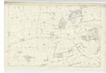
OS1/15/29/3
| List of names as written | Various modes of spelling | Authorities for spelling | Situation | Description remarks |
|---|---|---|---|---|
| DIRLETON T.P. | Dirleton Toll Bar Dirleton Toll Bar |
Sign Board Robert Hope |
005 | [Situation] About 1 1/2 Mile NW by N [North West by North] from East Fenton. A turnpike on the road leading from Dirleton to Aberlady, a short distance S.W. [South-West] of the village of Dirleton; the property of the trustees of the County. |
| MILL BURN | Mill Burn Mill Burn Millburn Cockle Mill Burn Cockle Mill Burn |
Robert Hope John Deans Statist: acct: [Statistical Account] 1841 Forests Map 1799 Johnston's Map |
005 | [Situation] About 1 Mile NW by W [North West by North] from East Fenton. A Small Stream which rises on the farm of Kilmurdie, and runs in a westerly direction to its junction with Peffer Burn, on the farm of Saltcoats. It is known by this name, from the point where two Streams unite, between the farms of Fentonbarns & Castlemains. |
Continued entries/extra info
[Page] 3Parish of Dirleton.
In forms 136 page
23 Dirleton T.P.
23 Mill Burn
Transcribers who have contributed to this page.
DANIALSAN, Douglas Montgomery
Location information for this page.
Linked mapsheets.


