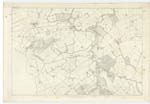
OS1/15/17/66
| List of names as written | Various modes of spelling | Authorities for spelling | Situation | Description remarks |
|---|---|---|---|---|
| HUMBIE WATER | Humbie Water Humbie Water Humbie Water |
Mr. John Milne Mr. T. Howatson Mr. Archibald Brown |
014 | A Stream which rises near Blegbie Hill and flows in a Northerly direction by Humbie Church to Keith Mill, where it is Joined by Keith Water; it Continues onwards till it Joins Birns Water. |
| KEITH WATER | Keith Water Keith Water Keith Water |
Mr. John Milne Mr. T. Howatson Mr. Archibald Brown |
014 | A Stream which rises near Falla, and flows in an Easterly direction by Costerton House, where it is named Costerton Water, - to a Bridge about 30 Chains S.E. [South-East] of Keith House where it takes the name Keith Water it falls into Humbie Water near Keith Mill. |
| KEITH WOODS | Keith Woods Keith Woods Keith Woods |
Mr. J. Milne Mr. T. Howatson Mr. A. Brown |
014 | A Tract of narrow Wooded Land along the North side of Keith Water and West Side of Humbie Water, Consisting of Mixed Forest and Fir Trees; The property of The Earl of Hopetoun. |
Continued entries/extra info
[Page] 66Parish of Humbie
Plan 14 .D.
Transcribers who have contributed to this page.
Bizzy- Moderator, Douglas Montgomery
Location information for this page.
Linked mapsheets.


