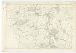
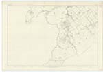
OS1/15/17/35
| List of names as written | Various modes of spelling | Authorities for spelling | Situation | Description remarks |
|---|---|---|---|---|
| HUMBIE | Parish of Humbie Parish of Humbie Parish of Humbie Parish of Humbie |
Stat Acct [Statistical Account] (1841) Full. [Fullarton's] Gazetteer of Scotland Co. [County] Map (1799) List of Farms Co. [County] Haddington |
014 ; 018 | [Situation] In the S. W. [South-West] side of Haddingtonshire A parish in the S. [South] Western extremity of Haddingtonshire. consisting of a main body stretching north west and south west, measuring about 6 miles in length and nearly 3 in average breadth, containing about 19.400 acres. It is bounded on the N.W. [North-West] by Ormiston, on the N. E. [North-East] by Salton, Bolton & Gifford on the South east by Berwickshire, and on the South west by Soutra and Edinburghsire. The detached part is wholly embosomed in the Co. [County] of Edinbro' [Edinburgh] measuring about 1 1/2 miles by 3/4. and lies about a mile distant from the main body. Population in 1831 was 875. It is in the Presbytery of Haddington and Synod of Lothian & Tweeddale. Patrons the Crown and the Earl of Hopeton. |
Continued entries/extra info
[Page] 35Parish of Humbie
[note] and is Situated about one Mile W.N.W. [West-North-West] of the village of
Fala, and on the N. [North] side of the Great Road
from DalKeith to Lauder - having the parish of Crichton
on the East and Cranston on the West &c
O.M.O. [Ordnance Mapping Office]
See remark 19-
Transcribers who have contributed to this page.
Bizzy- Moderator, MaxInSpain , Douglas Montgomery
Location information for this page.


