OS1/15/8/20


| List of names as written | Various modes of spelling | Authorities for spelling | Situation | Description remarks |
|---|---|---|---|---|
| CHESTERHILL | Chesterhill Chesterhill Chesterhill Chesterhill Chesterhill |
Rent Receipt Mr Thomas Henderson Revd [Reverend] George Weir Revd [Reverend] John Henry Forrest's Co [County] Map |
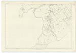
018 | [Situation] About 3/4 of a mile South by West from Upper Keith. A well constructed Farmhouse - the offices belonging to which are Called Mavishall. Occupied by Mr Thomas Henderson; the Property of Archibald Brown Esq. Johnstonburn House. There is no tradition whatever of a Roman Camp or Station in this locality. |
| MAVISHALL | Mavishall Mavishall Mavishall Mavis hall |
Mr Thomas Henderson Revd [Reverend] George Weir Revd [Reverend] John Henry Forest's Co [County] Map |
018 | [Situation] About 7/8 of a mile S. by E. [South by East] from Mavishall. The offices, Thrashing Mill, Saw Mill & Cottages belonging to Chesterhill Farm. They are so called from there having been a small dwelling house here, which was removed at the time they were erected. Archibald Brown Esq. Proprietor. |
| POGBIE BURN | Pogbie Burn Pogbie Burn Pogbie Burn |
Thomas Henderson Revd [Reverend] George Weir Revd [Reverend] John Henry |
018 | [Situation] Running in a northeasterly direction South of Mavishall A Small Stream which rises in the Lammermuir Hills; near Pogbie Hill and flows northwards by Pogbie to its Junction with Johnstonburn Water near Mavishall. |
Continued entries/extra info
[Page] 20Parish of Humbie
Plan 18B
Transcribers who have contributed to this page.
DANIALSAN, elxosn
Location information for this page.
Linked mapsheets.