OS1/15/7/16


| List of names as written | Various modes of spelling | Authorities for spelling | Situation | Description remarks |
|---|---|---|---|---|
| KIPPIT HILL | Kippet Hill Kippet Hill Kippit Hill Kippit Hill Kippit Hill |
Mr. J. Mack Mr. J. Lamb Johnstone's Co [County] Map Forests Co [County] Map Map in Stat: acct. [Statistical Account] |
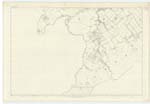
018 | [Situation] About 1 3/4 mile E. by S. [East by South] from Whitburgh House An eminence on the farm of Upper Keith. On it is a Trigl. [Trigonometrical] Station called by Trigl [Trigonometrical] Party "Upper Keith" |
| PARISH OF HUMBIE | (Ph) [Parish] of Humbie | See Name Book for Plan 14D | [Situation] In the S. [South] East portion of the County of Haddington For descriptive remarks see Name List for plan 14D |
Continued entries/extra info
[Page] 16Form 136 Page
Kippet Hill 32
Parish of Humbie 32
Transcribers who have contributed to this page.
Trondragirl- Moderator, as@electroniccottage.co.uk
Location information for this page.
Linked mapsheets.