OS1/15/6/24


| List of names as written | Various modes of spelling | Authorities for spelling | Situation | Description remarks |
|---|---|---|---|---|
| CRIB BURN | Crib Burn | Thomas Dods David Denholm George Redpath Alexander Dale |
017 | [Situation] Flows between the The Sting And Short Crib Rig. This is the Combination of Back Burn from where it receives Long Crib Burn to Monynut Water which it joins at a place where there formerly stood a house Called The Crib which was either a P.H. [Public House] or a Smithy, perhaps both. It was on the side of the old Road. |
| BACK RIG | Back Rig | Thomas Dods David Denholm George Redpath Alexander Dale |
017 | [Situation] West Side of Ewelairs Hill. A Ridge of Land partly reclaimed lying between Birky Cleugh and Whare Burn and extending from the E. [East] base of Ewelair's Hill to the County Boundary on the Middle Monynut Farm. |
| WHITE CLEUGH | White Cleugh | Thomas Dods David Denholm George Redpath Alexander Dale |
017 | [Situation] South Side of Ewelairs Hill. A Small Sheltered Valley at the South side of Ewelairs Hill on the farm of Middle Monynut thro' [through] which a Stream flows which joins Monynut Water. |
Continued entries/extra info
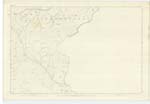
[Page] 24Plan 17C Parish of Oldhamstocks
Transcribers who have contributed to this page.
DANIALSAN, wilson5bh
Location information for this page.
Linked mapsheets.