OS1/15/4/23


| List of names as written | Various modes of spelling | Authorities for spelling | Situation | Description remarks |
|---|---|---|---|---|
| SPARTLETON | Spartleton Spartleton Spartleton Spartleton Spartledown Spartleton Spartleton Spartleton |
George Young Mr. Caverhill Johnston's Map Forrest's Map Stat. Acct. [Statistical Account] 1841 Published Reports of Dunbar Common Robert Boyd.- James Darling.- |
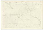
016 | [Situation] A little North of Gamelshiel Castle (Remains A considerable hill being one of the highest of the Lammermuir range. Its surface consists of heathy pasture. On it is a Trigl. [Trigonometrical] Station called by Trigl. [Trigonometrical] party "Spartleton" |
| HALL BURN | Hall Burn Hall Burn Hall Burn |
Robert Murdock George Young Forrest's Map |
016 | [Situation] Runs past Gamelshiel Castle (Remains of) and the North side of Summer Hill A small stream having its source on Spartleton flowing in a South West direction past the remains of Gamelshiel Castle and falling into Whiteadder Water. |
Continued entries/extra info
[Page] 23Parish of Stenton
[Forms 136 Page]
45 Spartleton
45 Hall Burn
Transcribers who have contributed to this page.
Nellie- Moderator, Douglas Montgomery
Location information for this page.
Linked mapsheets.