OS1/15/2/3


| List of names as written | Various modes of spelling | Authorities for spelling | Situation | Description remarks |
|---|---|---|---|---|
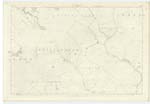
| WHITTINGHAM | Whittingham Parish | 016 | [Situation] In the S. E. [South-East] portion of the County. For Descriptive Rem: [Remarks] See Name Book Plan 11C For descriptive remarks see name list for plan, 11 A |
|
| LAMB HILL | Lamb Hill Lamb Hill Lambly Hill Lambly Hill Lamb Hill Lamb Hill |
Mr Blair John Rankine Johnston's Map Forrests Map Mr Brown Mr Crosbie |
016 | [Situation] About 1 3/8 Mile N.W. [North-West] by West from Friardykes A hill on the farm of Beltondod. Its surface consists of mountain grass land. On it is a Trigl. [Trigonometrical] Station called by Trigl. [Trigonometrical] Party "Johns Cleuch". Portion of this hill is in the Parish of Whittingham - the rest in Stenton (Detached). It is one of the Lammermuir Hills. |
Continued entries/extra info
[Page] 3Parish of Whittingham (Detached)
Transcribers who have contributed to this page.
Moira L- Moderator, as@electroniccottage.co.uk, Douglas Montgomery
Location information for this page.
Linked mapsheets.