OS1/9/14/66


| List of names as written | Various modes of spelling | Authorities for spelling | Situation | Description remarks |
|---|---|---|---|---|
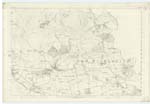
| Remains of the WALL OF ANTONINUS PIUS (Continued) | Remains of Fosse or Ditch of Roman Wall ( Continued | 023 ; 024 | [continued from page 65] ground was low & marshy, and where it was necessary to form drains beneath the works, to prevent the accumulation of water on their interior side. Roy supposes the ditch to have constituted the chief strength of the whole, and seems to consider the agger itself as having been of very secondary importance. He was evidently led to this opinion from the insignificant appearance which even the best preserved of its sections presented when he saw them; it must, however, be remembered, as a circumstance highly probable, that the rampart was, in course of time, much more liable to be demolished than the fosse to be filled up - hence, perhaps, the distinct appearance of the one compared with the other." Caledonia Romana, Pages 269, 278 & 279.- The Remains of the Fosse or Ditch of the Roman Wall, well known as "Graham's Dyke" to the farmers of every place it passes, may be said to be traceable from the eastern to the western Boundary of New Kilpatrick Parish. There are, however, some few exceptions of which the greatest length where the track is entirely obliterated, is near the point where the Wall crossed the Kelvin to the Fort of Balmuildy in Cadder Parish, Lanarkshire. The line between the parts where the connection is lost and cannot be shewn is well known, for in the time of the crops, in stubble, or when ploughed, the appearance is different in each case from that around the course of the Ditch. Every year the plough passes over the Ditch the hollow is extended, till, as in places where the connection is wanted, it becomes lost to the eye. Care has been taken throughout in surveying this antiquity to shew the actual width of the hollow as well as it can be defined at the present time - 1860. The hollow which the Ditch now forms presents four distinct appearances in the Parish; the first or faintest of which is shewn in the lightest shade used on the Examination Traces. This varies in width as represented and has a fall of from 1 to 3 feet from the level of the ground on the top to the bottom of the hollow. The remaining shades represent a gradual succession of steeper parts, the fourth being about equal to that of an ordinary cutting or embankment, except that the tops are not so defined or regular. "Ferguston Muir" is the only place in N. [New] Kilpatrick where the plough has never been through the Ditch. Here also are some faint but visible remains of the Wall of earth & stone &c., which is much broken & irregular on the top with its sides sloping - the one outwards to the Ditch & the other to the south or inner side. The highest part of this mound is not [continued on page 67] |
Continued entries/extra info
[Page] 66Co. [County] Dumbarton & Stirling -- New Kilpatrick Parish
Transcribers who have contributed to this page.
Alison James- Moderator, Jim-B
Location information for this page.