OS1/9/5/27


| List of names as written | Various modes of spelling | Authorities for spelling | Situation | Description remarks |
|---|---|---|---|---|
| STATION (Remains of) [Roman fort, Croy Hill] | Remains of Fort Remains of Fort Remains of Fort Remains of Fort |
Caledonia Romana T. Allan. Westerwood William Chalmers. Arniebog William Stark. E. [Easter] Dullatur |
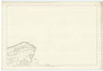
020 | "The next Station eastwards from Croy Hill is distant rather more than a mile and two thirds. Along this Section of the Fosse of Antoninus's Wall, the ground is comparatively low, with a slight declination to the north towards the level surface of the Dullatur Bog. The fort of Westerwood had been one of the third or weakest class; and but for the impassable swamps which must in ancient times have extended in front of its position. might be considered as one of the most exposed, along the wall, we may believe, however, that the marshes of Dullatur had afforded so certain a protection for at least a mile or two. in this neighbourhood, that the Station, such as it was, had proved amply sufficient for the purpose intended. The area of this Fort had measured about 370 by 320 feet, and was surrounded by a single rampart and ditch. In Gordon's time, the site of the Praetorium, near the centre of the inclosure was perfectly distinct; while, built in the cottages which then stood in its neighbourhood, he observed many fragments of Roman Sculpture - amongst others a very singular one of a style which we may suppose was not uncommon among the Lampsacenians of ancient Mysia. The Valla of this fort are now entirely levelled, and it does not appear that any other remains than the fragments mentioned by Gordon have ever been discovered in its vicinity" Caledonia Romana This, the 11th fort on the line of Wall numbering from the Clyde on the west (See Cal. [Caledonia] Romana page 367) including the Castellum or watch Tower in Cadder, and the supposed existence of a fort or Station on Croy Hill, is now almost obliterated. Its form however is traceable, and, with a slight exception on the remains of its southern side - numbered 2 on Examination Trace, the remains are about equal to the faintest parts of the Fosse - a perceptible hollow. ( See description & Index of the shades used for the Fosse in Name Sheet). Several dressed rough freestones taken from the ditch of this Fort, are to be seen lying in the Farm Yard of "Westerwood", and many similar stones are built into the Farm house. No Sculptured Stones, as mentioned in the Caledonia Romana, are to be seen here now. On coming near the Fosse of the Wall, the track of the north-east and north-west angles of this Fort are altogether levelled. It is well known in the locality as the "Camp". The west end of the Farm house cuts upon its east side near the Ditch of the R. [Roman] Wall. The Bog of Dullatur, which at one time would have protected this Fort, has been Cultivated for a considerable time, & the name of the Bog consequently lost, or not now retained to any part of the old bog lands of Dullatur. |
Continued entries/extra info
[Page] 27Dumbartonshire -- Cumbernauld Parish
[Sideways alongside description:]
Page 336
[Below description:]
Bot. [Bottom] 450 ft. [feet] sq. [square] -- Present - 370 ft. [feet] by 320 ft. [feet]
([ ]).............................................................................................................CR
Transcribers who have contributed to this page.
Alison James- Moderator, Molly Miller
Location information for this page.
Linked mapsheets.