OS1/9/5/123


| List of names as written | Various modes of spelling | Authorities for spelling | Situation | Description remarks |
|---|---|---|---|---|
| LUGGIE WATER | Luggie Water Luggie Water Luggie Water Luggie Water Luggie Water Luggie Water Head of Logie Water |
Forrest's Co [County] Map of Lanark New Statl. [Statistical] Account Fullarton's Gazetteer R. Aitken. Glencryan Revd. [Reverend] H. Park Revd. [Reverend] H. Baird Johnstons Co [County] Map of Dumbarton |
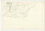
026 | This little River forms the Southern Boundary of the Parish from its head at "Fannyside Muir" (Trace 2. 26-10) which comes from a well known Chalybeate Spring, Known as "Toddle Well", which is on the New MonKland side of the Boundary at the place shewn on Trace referred to. "Luggie (The), a rivulet of Lanarkshire, and the detached part of Dumbartonshire. Issuing from a small laKe on the Boundary between the Counties, near the south-east extremity of the Parish of Cumbernauld, it Runs 6½ miles westward along the boundary augmented in its Progress by four or five feeders from Lanarkshire." Fullarton's Gazetteer The Burn which comes through Glenhoof in New Monkland* is commonly considered the proper source of this Water, but as quoted from the Gazetteer & Co [County] Map, its proper head seems to be from the "Toddle Well", which is the head of the Stream running from that point along the Southern By. [Boundary] of this Parish. From the Toddle Well to "Rumblybugs" it is commonly called by the people " Toddle Burn", a name which properly belongs to the Spring or well as it is called, & has not therefore been written to the part described from its inconsiderable length. |
Continued entries/extra info
[Page] 123Dumbartonshire -- Cumbernauld Parish
Transcribers who have contributed to this page.
Alison James- Moderator, DANIALSAN, Molly Miller
Location information for this page.
Linked mapsheets.