OS1/10/53/28


| List of names as written | Various modes of spelling | Authorities for spelling | Situation | Description remarks |
|---|---|---|---|---|
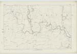
| FELL HILL | Fell Hill | James Fairbairn Westerker Mains John Linton Shielburnfoot |
035 | [Situation] About 1/2 Mile S.E. [South East] of Crooks. A Considerable eminence of a Somewhat Conical Shape on the farm of Georgefield. It is Situated East of Megget Water and South of the Stanish Water. The surface of Which is Covered with Rough pasture and on its summit is a Trig [Trigonometrical] Station. |
| KIRK GILL | Kirk Gill Kirk Gill |
James Fairbairn Westerker Mains John Linton Shielburnfoot |
035; 036 | [Situation] 3/4 of a Mile S.E. [South East] of Crooks. A glen or hollow with a Stream flowing through it. Situated a little East of Fell Hill |
Continued entries/extra info
[Page] 28Parish of Westerkirk -- Sheet 35 No 8 Trace 6
Transcribers who have contributed to this page.
DANIALSAN, Larry mag
Location information for this page.
Linked mapsheets.