OS1/10/51/3


| List of names as written | Various modes of spelling | Authorities for spelling | Situation | Description remarks |
|---|---|---|---|---|
| BYRE SIKE | Byre Syke Byre Syke |
Thomas Anderson Shepherd Glendinning James Anderson Shepherd Greensykes |
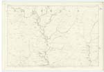
026 | [Situation] West Side of Byre Rig. A small stream which gathers between Southgrain Pike and the Leas and flows in a southerly direction until it joins the Burn which runs through Kirk Cleugh |
| BYRE RIG | Byre Rig Byre Rig |
Thomas Anderson Shepherd Glendinning James Anderson Shepherd Greensykes |
026; 027 | [Situation] ¼ of a mile East of the Leas. A slight elevation West of Byre Syke on the farm of Glendinning the surface of which is rough pasture. The property of Frederick Johnston of Westerhall. |
| FLOW HILL | Flow Hill Flow Hill |
Thomas Anderson Shepherd Glendinning James Anderson Shepherd Greensykes |
026 | [Situation] ¼ of a mile S.W. [South West] of The Leas. An Eminence Covered with rough pasture Situated ½ mile west of The Leas. |
| THE FLOW | The Flow | Thomas Anderson Glendinning | 026 | [Situation] ½ Mile S.W. [South West] of The Leas. A flat piece of heathy pasture Situated to the South of Flow Hill. |
Continued entries/extra info
[Page] 3Parish of Westerkirk Sheet 26 No. 4 Trace 2
Transcribers who have contributed to this page.
Chr1smac -Moderator, DANIALSAN
Location information for this page.