OS1/10/50/87


| List of names as written | Various modes of spelling | Authorities for spelling | Situation | Description remarks |
|---|---|---|---|---|
| DUNDORAN | Dundoran Hill Dundoran Hill Dundoran Hill Dundoran Dundoran |
David Rogerson Leithenhall William Bell Leithenhall Thomas Kennedy Killbrook Johnstons County Map J.S.Wightman Esqre. of Courance |
025 | [Situation] 3/4 mile W. [West] from Laverhay A Considerable hill situated in the immediate neighbourhood of Killbrook and on the summit of which is a Trig [Trigonometrical] Station. |
| LEITHENHALL HOPE | Leithenhall Hope Leithenhall Hope Leithenhall Hope |
David Rogerson Leithenhall William Bell Leithenhall Thomas Kennedy Killbrook |
025 | [Situation] 47 Chains West from Laverhay. This name applies to an extensive glen through the centre of which runs Leithenhall Burn |
| LEITHENHALL BURN | Leithenhall Burn Leithenhall Burn Leithenhall Burn |
David Rogerson Leithenhall William Bell Leithenhall Thomas Kennedy Killbrook |
025 | [Situation] From the junction of runners 24 Chains W. [West] from Broadfield Height - South to Wamphray Water. A Rivulet having its source about 1 1/2 mile to the N.W. [North West] of Leithenhall and runs in a southerly direction till it joins Wamphray Water. |
Continued entries/extra info
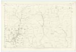
[Page] 87 -- Parish of Wamphray -- Plan 25.9 Trace 2Philip Munro
Lce Corp. R.E. [Lance Corporal Royal Engineers]
Transcribers who have contributed to this page.
Chr1smac -Moderator, stellas
Location information for this page.
Linked mapsheets.