OS1/10/50/84


| List of names as written | Various modes of spelling | Authorities for spelling | Situation | Description remarks |
|---|---|---|---|---|
| ROMAN ROAD [Wamphray parish] | Roman Road Roman Road Roman Road Roman Road |
Charles Stewart Esq John Little of Newton Map of North Britain Roman Antiquities of Scotland by General Roy |
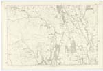
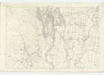
024; 033 | [Situation] From N. to S. [North to South] of the West side of this Parish.- Applies to the TurnpiKe Trust leading through Wamphray which forms the Ancient Site of a Roman Military way which entered the Co. [County] at Longton and extended to Gallaberry Hill in the Ph. [Parish] of Drysdale, here the line divided, Sending the Main line through this Ph. [Parish] and Kirkpatrick Juxta, thence by Ericstane (a hill) Little Clyde and terminated its Course at Dumbarton after joining it is Said Antoninus' Wall. "It Crosses the River Annan after an Eastern Course of 18 miles at Burnfoot, it then pursues its Course Along the Western banK of the Annan to Tatius-holm and the Mouth of the Evan Water. Honble. [Honourable] H.H. |
Continued entries/extra info
[Page] 84-- Parish of Wamphray-- Plan 24.12 Trace 3Roman Road situation From North to South of the West side of this Parish
[Signed] M Donohue
4th May 1857
Transcribers who have contributed to this page.
Chr1smac -Moderator, stellas
Location information for this page.