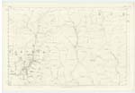
OS1/10/50/65
| List of names as written | Various modes of spelling | Authorities for spelling | Situation | Description remarks |
|---|---|---|---|---|
| DUNDORAN | Dundoran Dundoran Dundoran Dundoran |
William Carruthers Farmer William Bell Shepherd William Laidlaw Shepherd C Stewart Esqr. (Hillside) Johnstons Co. [County] Map |
025 | [Situation] 53 Chains S.E. [South East] of Rispie Hill A very prominent ridge shaped hill on the farm of Leithenhall. |
| LEITHANHALL BURN | Leithenhall Burn Leithenhall Burn Leithenhall Burn |
William Carruthers Farmer William Bell Shepherd William Laidlaw Shepherd |
025 | [Situation] From the junction of runners 24 Chains West from Broadfield Height South to Wamphray Water A small stream rising in Leithenhall Hope through which it runs and empties itself into Wamphray Water |
| STOTS CLEUCH | Stots Cleugh Stots Cleugh Stots Cleugh |
William Carruthers Farmer William Bell Shepherd William Laidlaw Shepherd |
025 | [Situation] 1/4 mile S.W. [South West] of Broadfield Height. Applied to a rocky glen, through which runs a Small Stream. |
Continued entries/extra info
[Page] 65 -- Parish of Wamphray -- Plan 25.5 Trace 5[Signed] Charles J Fearnside
S.R.E. [Sapper Royal Engineers]
Transcribers who have contributed to this page.
Chr1smac -Moderator, stellas
Location information for this page.
Linked mapsheets.


