OS1/10/50/58


| List of names as written | Various modes of spelling | Authorities for spelling | Situation | Description remarks |
|---|---|---|---|---|
| DRY LINN | Dry Linn Dry Linn Dry Linn |
William Proudfoot Newbigging John Graham Newbigging Andrew Johnstone Moffat |
024 | This name applies to a deep glen alias a cleugh situated about 1/2 mile to the north of Newbigging, the name is well known in the locality. |
| HODDOM'S PLANTATION | Hoddoms Plantation Hoddoms Plantation Hoddoms Plantation |
William Proudfoot Newbigging John Graham Newbigging Andrew Johnstone Moffat |
024 | A small wood on the farm of Newbigging. Its wood consists of -- Formerly the property of Gen[General] Sharp of Hoddam Parish hence the name. |
| NEWBIGGING | Newbigging Newbigging Newbigging Newbigging |
William Proudfoot Newbigging John Graham Newbigging Andrew Johnstone Moffat Ancient and Modern Valuation Rolls of the County by Commissioners of Supply |
024 | A Farmhouse and outbuildings with garden and lands attached occupied by William Proudfoot, the property of George Carruthers Esq[Esquire] |
| NEWBIGGING BURN | Newbigging Burn Newbigging Burn Newbigging Burn |
William Proudfoot Newbigging John Graham Newbigging Andrew Johnstone Moffat |
024 | A Rivulet formed by the Confluence of the Brunstone Burn and Mirk Gill and runs in a southerly direction to its confluence with the River Annan. |
Continued entries/extra info
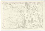
58 Parish of Wamphray Plan 24.8 Trace 4Unable to read extreme right of page
Hoddoms Plantation situation About 27 Chains North East by North from Newbigging
Dry Linn situation About 10 Chains to the North of Hoddoms Plantation
Newbigging situation In the Western Parish district
Newbigging Burn situation From the junction of Bruntstane Burn and another stream - south West by South to River Annan.
Philip Munro Lance Corporal Royal engineers.
Transcribers who have contributed to this page.
stellas
Location information for this page.
Linked mapsheets.