OS1/10/50/162


| List of names as written | Various modes of spelling | Authorities for spelling | Situation | Description remarks |
|---|---|---|---|---|
| LANGSIDE HILL | Langside Hill Langside Hill Langside Hill |
John Rogerson Fingland James Rogerson Fingland Mr Hamilton Saughtrees Estate Map 1765 Valuation Roll of the County |
034 | A hill of uncultivated ground situated, on the farm of Langside. |
Continued entries/extra info
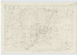
162 Parish of Wamphray Sheet 34.1 Trace 5Swairlinns Plantation
Swair Linns Plantation
Mr Hamilton Saughtrees
John Rogerson Fingland
Estate Map 1765
Ancient and Modern Valuation Roll of the County by Commissioners of Supply
A young Plantation of fir and oak, closely planted and in a thriving condition., situated on the march betwixt the farms of Saughtrees, end and Langside.
Derives its name from being a Sware or Hillside and some single streams running through which are termed linns.
Swairlinns Plantation situation 1/2 mile South South East from Saughtrees
Langside Hill situation 68 Chains South South East from Saughtrees
Drycleugh Syke
John Rogerson
James Rogerson
Mr Hamilton
A small and shallow stream gathers near Cumstonstaks Plantation, and joins the Back Burn at Horsemanse
Drycleugh Syke situation From 3/4 mile South South East of Blaze Hill, South to Back Burn.
John Jane Sapper Royal Engineers
Transcribers who have contributed to this page.
stellas
Location information for this page.
Linked mapsheets.