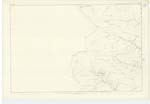
OS1/10/49/49
| List of names as written | Various modes of spelling | Authorities for spelling | Situation | Description remarks |
|---|---|---|---|---|
| MULLWHANNY | Mulwhannie Mulwhannie Mulwhannie Mullwhanny Mullwhanny Mullwhanny |
William McCaw Adam Glover William Proudfoot William Wilson Glencairn William Todd Glencairn John Ferguson Glencairn |
020 | [Situation] On the Western Parish Boundary. A large round hill of considerable eminence within the farm of Appin, the Watershed of which forms the boundary between this parish and that of Glencairn May signify the hill abounding with lambs compd. [comprised] of Mull & vanaichie |
| SHIEL CLEUCH | Sheil Cleuch Sheil Cleuch Sheil Cleuch Shiel Cleuch |
William McCaw Adam Glover William Proudfoot Robert Newal |
020 | [Situation] From 48 Chains South of Yearn Craig, extending N.N.E. [North North East]. A small natural hollow between Mulwhannie and Transparra hills, the stream flowing through which falls into Appin Burn. from Shield - a shelter. |
| WETHER HILL | Wether Hill Wether Hill Wether Hill |
William Wilson Glencairn William Tod Glencairn John Ferguson Glencairn |
020 | [Situation] On the Wn. [Western] Parish Boundary. A hill of considerable altitude situate on the Boundary between this Parish and Glencairn. |
Continued entries/extra info
[Page] 49Parish of Tynron Plan -- 20-16 Trace 1
[Signed] W. Paterson c/a [civilian assistant]
Transcribers who have contributed to this page.
CorrieBuidhe- Moderator, Brenda Pollock
Location information for this page.
Linked mapsheets.


