OS1/10/49/2


| List of names as written | Various modes of spelling | Authorities for spelling | Situation | Description remarks |
|---|---|---|---|---|
| TYNRON | Tynron Tynron Tynron |
Walkers' Map of Scotland Crawford's Map of Dumfriesshire Johnston's Map of Dumfriesshire |
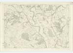
020; 021; 029; 030; 031 | [Continued from page 1] mistaken for gold. There is accordingly no minerals wrought, neither is there any manufacture carried on - the district is consequently entirely rural. The hill have in most instances a gentle acclivity indeed the only exceptions being Craigturrah and Croglin Craig which are bold and precipitous. Tynron Doon which may have an elevation of 600 feet, is situated near the Sn. [Southern] extremity of the Parish, regular and of Conical shape, it presents a somewhat prominent face towards the South. As seen from the Vale of Nith, it is the conspicuous hill feature of this district. Bail Hill on the Western Boundary is stated to be the greatest elevation. Lamgarroch towards the N.Wn. [North Western] district is nearly of equal height vizt. 1800 ft. [feet] above sea level. The most considerable streams are the Shinnel and the Scar, the former rising near the head of the Parish runs S.E. [South East] through the whole length dividing the entire district into two nearly equal parts. The Scar, the largest tributary of the Nith, forms the Boundary with Penpont for about 3 miles on the North. Numerous other streams all having their sources within this Parish - some of which being of considerable bulk - contribute their waters to those of the Scar and the Shinnel. There is only one Turnpike Road which runs in a S.W. [South West] across the Southern district for about 2 1/2 miles to Moniaive in Glencairn. There is only one village Tynron, which consists of a few detached houses, - two and one storey high - all in good repair. In it are the Parish Church, an endowed School, a Sub Post Office and one Grocers Shop. There is only one Church in this Parish, which is Parochial and which is reported to have been partly built with stones taken from the Fort on Tynron Doon. Though of small dimensions, its style is graceful and rich and approaches to that of the Corinthian. It has Accommodation for 314 Sitters. Patron the Duke of Buccleuch. There is also one Parish School situate about 2 miles N.W. [North West] from Tynron village. Population of the Parish 474. (in 1853) The Roman Road is reported by various Authorities to have traversed this Parish. The New Statistical Account says "There are the remains of a Roman road leading from the Doon to Drumloff and crossing the Shinnel above Stenhouse, - along the line of which Roman urns have been found filled with calcined bones" notwithstanding which and due research and enquiry on the ground, Examiners have been unable to discover any traces of this road. On Tynron Doon the entrenchments of an Ancient Fort are well defined. "The foundations of an extensive building might lately have been traced on the top of this hill and it is stated in Blacks manuscript history of the Presbytery of Penpont deposited in the Advocates' Library that King Robert the Bruce after the death of Cummin was conducted to this as a place of safety" Statistics. If Chalmers interpretation of the Name of the Parish be correct, the period to be assigned to the origin of this stronghold must be that of the Scots-Irish or British. Black's manuscript however goes on to say that on Tynron Doon "there were very thick woods and great about that place - and it is reported that during his (Bruce's) abode there, he did often divert to a poor man's Cottage named Brownrig where he was content with such mean accommodation as the place could afford." This shews that the Fort was at that date untenable and it is probable that Bruce selected Tynron Doon not as a place of concealment but that - commanding as this hill does the entire Vale of the Nith - he deemed it the most advantageous position for descrying his enemies on their approach to or from the town of Dumfries, - "diverting to the poor man's Cottage" &c. during night. It is asserted in the district that several large stones were taken from this Fort - there are however no indications on the ground whereby to confirm the existence of a stone building and the most correct construction upon this Antiquity would seem to be that suggested by Chalmers in the Name of the Parish, that this Fort originated in the Ancient British or Scots-Irish period, which in fact may be farther confirmed by the features of existing entrenchments. "There was formerly a place of religious worship at Kirkconnel, which like other places of the name was dedicated to St. Connel" Statistics. Three Barrows or Cairns existed in this Parish which are said to have been opened about a Century ago, all traces of which have now disappeared. Novr. 15/56. [November 15 1856] |
Continued entries/extra info
[Page] 2Parish of Tynron -- County of Dumfries
Transcribers who have contributed to this page.
CorrieBuidhe- Moderator, Brenda Pollock
Location information for this page.
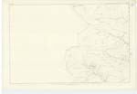
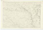
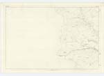
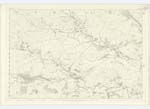
Linked mapsheets.