OS1/10/49/121


| List of names as written | Various modes of spelling | Authorities for spelling | Situation | Description remarks |
|---|---|---|---|---|
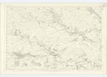
| TYNRON DOON | Tynron Doon Tynron Doon Tynron Doon Dune of Tynron Tynron Doon Fort Tynron Doon Fort |
Rev. [Reverend] Mr Wilson John Kennedy Esq. John Paterson History of Galloway - 1684. Statistical Account of Tynron Gazetteer of Scotland |
030 | [Situation] 1 mile N.E. [North East] from Tynron village A steep conical hill of considerable eminence on which there had been once a strong fortification. About six years ago the farmer removed twenty cart loads of hewn stones from the summit of the hill. * *In the Barony of Aird pertaining to Sir Robert Grierson of Lagg, is the Dune of Tynron, on the top of which there hath been some Dune or Fort, it is not known by whom it was inhabited, whether Romans, Picts or Scots. To this place Robert Bruce was conducted by Roger Kirkpatrick of Closeburn, after they had killed the Cummin [Comyn] at Dumfries, which is 9 miles from this place. It is stated while here, that he did often divert to a poor mans cottage named Brownrig situate in a small parcel of stony land incompassed with woods, where he was content with the accomodation as the place could afford, the poor man's wife being advised to petition the King for somewhat, was so modest in her desires, that she sought no more but security for the croft in her husbands possession, and liberty of pasturage for a very few Cattle on the hill, and the rest of the bounds, of which privilege that ancient family by the injury of time, hath long been deprived, but the Croft continues still in possession of their Heirs & successors - they still retain the old charter. Symson's Hist. [History] of Galloway 1684. |
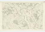
| CRAIGNEE BURN | Craignee Burn Craignee Burn Craignee Burn Craignee Craignee |
Thomas Smith Robert Newall Thomas Sloan Johnston's Co. [County] Map Valuation Rolls |
030; 031 | [Situation] From 1/2 mile South of Craignee - East to Scar Water. A small burn flowing through the farm of Clonrae. Sometimes called Lag Burn from an old farm which formerly stood in the glen through which it flows. Has its source 1/2 mile South of Craignee & falls into the Scar Water. |
| CRAIGNEE WOOD | Craignee Wood Craignee Wood Craignee Wood Craignee Wood Caignee Wood |
John Paterson Thomas Smith John Walker Johnston's Co. [County] Map Valuation Rolls |
030; 031 | [Situation] Near En. [Eastern] Parish Boundary 1 1/2 mile NE. [North East] from Tynron. A plantation of forest trees within the old farm of Craignee mow included in that of Clonrae. |
Continued entries/extra info
[Page] 121Parish of Tynron -- Plan 30-8 Trace 3
[Signed] W. Paterson c/a [civilian assistant]
Transcribers who have contributed to this page.
CorrieBuidhe- Moderator, Brenda Pollock
Location information for this page.