OS1/10/47/59


| List of names as written | Various modes of spelling | Authorities for spelling | Situation | Description remarks |
|---|---|---|---|---|
| BARLOUTH MOOR | Barlouth Moor Barlouth Moor Barlouth Moor |
Joseph Kerr William Graham William Richardson |
050 | [Situation] 1 1/2 Mile N.N.E. [North North East] of Torthorwald Village. A large tract of arable and R. P. [Rough Pasture] land formerly a moor, attached to Barlouth Farm. |
| COCKETFIELD MOOR | Cocketfield Moor Cocketfield Moor Cocketfield Moor Cocketfield Moor |
William Graham William Richardson Andrew Kirkpatrick Johnstone's Co. [County] Map |
050 | [Situation] 1 1/2 Mile S.E.E. [South South East] of Torthorwald Village. A tract of Moorland the greater part of which is Cultivated, attached to the farm of Cockiefield. |
| LINNS BURN | Linns Burn Linns Burn Linns Burn |
William Graham James Johnstone Mr Kirkpatrick |
050 | [Situation] Running from Cocketfield Moor in a S. Wn. [South Western] direction, and partially tracing En. [Eastern] Parish Boundary. A Small Stream having its Source near the Ph. By.[Parish Boundary] passes by the farm of the Linns, joins Pierbanks Burn - thence the United Waters bear the name Wath Burn Owl Burn |
Continued entries/extra info
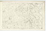
[Page] 59Plan 50.10 Parish of Torthorwald
[Signed] Owen Barrett
Transcribers who have contributed to this page.
DANIALSAN, lowlandscot
Location information for this page.
Linked mapsheets.