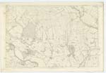
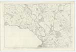
OS1/10/46/9
| List of names as written | Various modes of spelling | Authorities for spelling | Situation | Description remarks |
|---|---|---|---|---|
| ANNFIELD MOOR | Annfield Moor Annfield Moor Annfield Moor |
James Harper, Annfield William Nicholson, Moorhouse James Henderson, Amisfield Town James Morgan |
041 | [Situation] At Wn. [Western] side of Parish 3 miles N.N.W. [North North West] of Tinwald village A large tract of moorland so called from it being on the farm of Annfield |
| BLACK LOCH | Black Loch Black Loch Black Loch Black Loch |
James Harper William Nicholson James Henderson James Morgan Johnstone's Co[unty] Map |
041 | [Situation] At N.Wn. [North Western] extremity of Parish about 4 miles N.N.W. [North North West]of Tinwald village A large pond situated at the north of Annfield Moor |
| PARK BURN | Park Burn Park Burn Glenae Burn |
Andrew Gillison, Amisfield Town Janes Henderson James Harper |
041; 049 | [Situation] Partially tracing Wn. [Western] Boundary. A small stream having its source in the Parish of Kirkmahoe it flows along and forms part of the Parish Boundary between Kirkmahoe and Tinwald, it bears this name until it joins Lochar Water at Lochar Bridge. |
Continued entries/extra info
[Page] 9Parish of Tinwald Plan 41/7 Trace 1
[Signed] Samuel S Hill Lce. Corpl RS&M [Lance Corporal Royal Sappers & Miners]
Transcribers who have contributed to this page.
Brenda Pollock
Location information for this page.


