OS1/10/44/25
| List of names as written | Various modes of spelling | Authorities for spelling | Situation | Description remarks |
|---|---|---|---|---|
| CRAWICK WATER | Crawick Water | Fullerton's Imperial Gazatteer [Gazetteer] History of Sanquhar |
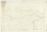
002; 003; 005; 006 | [Situation] On Wn. [Western] Parish Boundary - S.W. [South West] to River Nith . A large Water formed by the junction of the Spango & Wanlock Waters; it runs South - through the Plan, and falls into the Nith about ½ a mile W. [West] of Sanquhar. |
| BROWN'S CLEUCH | Brown's Cleugh Brunto Cleugh |
James Brown History of Persecution Old Estate Map North half of Sanquhar |
002 | [Situation] Adjoining Crawick Water on the East, About 4½ miles N.N.E. [North North East] from Sanquhar Burgh. A Cleugh on the South side of Craig North Hill, a burn runs through it and falls into the Crawick Water about ¾ of a mile North of Cogg House, derives the name from a man of the name of Brown being shot in the Cleugh during the Persecution. |
| CRAIGNORTH HILL | Craig North Hill | James Brown Duke of Buccleugh's Estate Plan |
002 | [Situation] About 4¾ miles N. N. E. [North North East] from Sanquhar Burgh. A Prominent Hill on the East side of Crawick Water; and very steep on the West side. About 1 mile North of Cogg House and 5½ miles North of Sanquhar. |
Continued entries/extra info
[Page] 25,Parish of Sanquhar -- Plan 2. 16. Trace 1.
[Page is signed]
Charles J Fearnside
Pte. [Private] R. S. & M's. [Royal Sappers and Miners]
Transcribers who have contributed to this page.
George Howat
Location information for this page.


