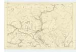
OS1/10/44/232
| List of names as written | Various modes of spelling | Authorities for spelling | Situation | Description remarks |
|---|---|---|---|---|
| AUCHENGRUITH | Auchengruich Auchengruith Auchengruith Auchengrouth Auchengruith |
Old Estate Map Rent Receipt & Lease James Dalziel Revd. Dr. [Reverend Doctor] Simpson Johnstones Co. [County] Map, |
006 | [Situation] About 2 1/2 miles East of Sanquhar Burgh A good stone building 2 Stories High; with offices attached all slated and in good repair, it is built near the site of Castle Gilmour, an old established name. Auchengrouth means the field of curds and may be the right mode of Spelling. Gruith or Gruth is Curds. The name however probably means, the desolate, or waste field, compd [compounded] of Auchen & Grug or Grig the latter word sounding as if written gruich or gruik. - The old Estate Map is accordingly correct.- |
| AUCHENSOW | Auchensue Auchensow Auchensow Auchensow Auchensue Auchensow |
Old Estate Map Black,s Co. [County] Map James Dalziel Revd. Dr. [Reverend Doctor] Simpson Popular pronunciation, Johnston's County Map |
006; 007 | [Situation] 1/2 mile S. E. [South East] of Auchengruich.- A good stone building 1 Story High with Offices attached, all slated and in good repair except the Barn which is in ruins. Formerly a Small farm town now in with Dalpeddar. This is probably a corruption of Auchensuighe - the field of the moist or sappy soil.- |
| MILL HILL | Mill hill Mill-hill Mill-hill |
James Dalziel William Tennant W. Carruthers |
006 | [Situation] 34 Chains S.W.W. [South West West] from Auchensow, A round topped Hill or Knowe above Mennock Water. A mill stood at the foot of it at one time from which it derives its name but it as disappeared a long time ago. |
| MENOCK WATER | Minnick Water Mennock Water Menock Water Menock Water |
Fullartons Gazatteer James Dalziel Revd. Dr. [Reverend Doctor] Simpson Statist. Acct. [Statistical Account] of Dumfries & Inverness |
007; 013 | A large Stream having its source at the foot of the Lowther Hills and after a run of about 5 miles falls into the Nith a little below Mennock Bridge |
Continued entries/extra info
[Page:] 232Parish of Sanquhar -- Plan 6.16 Trace No. 6.
[Signed:]
Charles J Fearnside
Pte. [Private] R.S.& M's. [Royal Sappers and Miners]
Transcriber's notes
Feint writing at bottom of the page.Transcribers who have contributed to this page.
Chr1smac -Moderator, George Howat
Location information for this page.


