OS1/10/43/103


| List of names as written | Various modes of spelling | Authorities for spelling | Situation | Description remarks |
|---|---|---|---|---|
| BLACKSHAW BANK | Blackshaw Bank Blackshaw Bank Blackshaw Bank |
William Chambers Robert Chambers Joseph Johnstone |
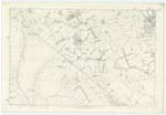
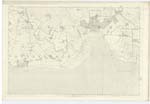
061 | [Situation] Extending from Lochar Water S.W. [South West] to low water of Solway Firth A large track of sand dry at low water, bounded by Lochar water on the east and by the Parish of Caerlavarock on the north and extending south & west until it meets low water or Channel of the Solway Frith. |
| LOCHAR WATER | Lochar Water Lochar Water Lochar Water |
William Thomson William Dunbar Joseph Johnstone |
056; 061 | [Situation] Between Blackshaw and Priestside Bank A Slow-running river rising near Tinwald village and flowing in a southerly direction through Lochar moss It passes the village of Bankend on the right and from thence it flows in a southeasterly direction until it falls into the Solway Firth near Brow well |
| THWAITE BURN | Thwaite Burn Thwaite Burn Thwaite Burn |
David Beck William Dunbar James Thomson |
056; 061 | [Situation] From near N.En [North Eastern] Parish Boundary South to Lochar Water A small stream rising near the east of this Parish and flowing past the Farm of Thwaite falls into Lochar water about 1/2 a mile south west of Ruthwell Village |
Continued entries/extra info
[page] 103Parish of Ruthwell -- Plan 61.12 -- Trace 1
[signed] John Houston
Transcribers who have contributed to this page.
Moira L- Moderator, norma
Location information for this page.