OS1/10/41/45


| List of names as written | Various modes of spelling | Authorities for spelling | Situation | Description remarks |
|---|---|---|---|---|
| MOUSWALD BURN | Mouswald Burn Mouswald Burn Mouswald Burn |
Revd. [Reverend] AB. Murray, Mouswald Mr. A. Sloan. Horseholm Mr. Carruthers Brocklehurst. |
056 | [Situation] Near Wn. [Western] side of Parish running W. [West] and S,w, [South west] A stream which begins in the Ph. [Parish] of Dalton runs through the heart of Mouswald and empties itself into Black Grain near Horseholm. |
| WATH BURN | Wath Burn Wath Burn Wath Burn Wath Burn |
Revd. [Reverend] A B. Murray Mouswald Mr. A. Sloan Mr. Carruthers Gazetteer of Scotland, |
050; 056 | [Situation] Tracing Wn. [Western] Parish Boundary A stream through this Plan, which divides Phs. [Parishes] Torthorwald and Mouswald & also two properties. It runs into Lochar Water. |
| LOCHAR MOSS | Lochar Moss Lochar Moss Lochar Moss |
Gazetteer of Scotland Mr. Sloan Revd. [Reverend] A. Brown mt. Kedar, |
056 | [Situation] Forming S.wn, [South western] section of this Parish A large and extensive morass or bog parts of it are very wet along the outskirts vast quanties [quantities] of peats are got. all of it on this Plan is the property of Robert Paterson of Nunfield, |
Continued entries/extra info
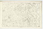
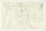
[Page] 45Parish of Mouswald -- Plan 56. 9. Trace 1.
[Signed] M. Donohue
Transcribers who have contributed to this page.
mac1
Location information for this page.