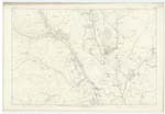
OS1/10/39/45
| List of names as written | Various modes of spelling | Authorities for spelling | Situation | Description remarks |
|---|---|---|---|---|
| COMMONSIDE | Commonside Commonside Commonside |
David Dinwoodie Esq[Esquire]Moffat John Bell Esq [Esquire] Moffat Thomas Thompson Commonside |
016 | Two Cottages with outbuildings [all in bad repair] garden and a few acres of land attached, the property of the Poor of Moffat. |
| RIDDINGS | Reddings Reddings Reddings Riddings Riddings Riddings Reddings Riddings Riddings- porobably cleared land see Riddin- cleared off |
David Dinwoodie Esq[Esquire] John Bell Esq[Esquire] Thomas Thompson Johnston's County Map Valuation Roll 1827 Valuation Roll 1667 Mew Statistical Account Crawford's County Map Dr[Doctor] Jamieson's Dicty[Dictionary] |
016 | A farm house and outbuildings with garden and lands attached, in good repair, the property of Mrs Todd |
| RIVER ANNAM | River Annan River Annan River Annan |
David Dinwoodie Esq[Esquire] John Bell Esq [Esquire] Thomas Thompson |
016; 024 | A considerable river which rises about 5 miles to the north of Moffat and flows in a southerly direction through Annandale, at length falling into the Solway Firth. |
Continued entries/extra info
Page 45 Parish of Moffat Plan 16.3 Trace 1Commonside situation Near the North West corner of this Plan
River Annan situation On the Western Parish Boundary
Riddings situation 5 Chains East of Western Parish Boundary
Philip Munro Ln[Lance] Corp[Corporal] RE[Royal Engineers]
Transcribers who have contributed to this page.
stellas
Location information for this page.


