OS1/10/38/198


| List of names as written | Various modes of spelling | Authorities for spelling | Situation | Description remarks |
|---|---|---|---|---|
| GILBERT'S RIG | Gilbert's Rig Gilbert's Rig Gilbert's Rig |
Adam Tait, Newton Robert Murray, Gardenholm Peter Murray Greenhill |
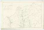
[Situation] 1/2 mile East from Torr Hill. An eminence of great height of a ridge like shape and on the summit of which is the site of the old Roman road. |
|
| BUSHEL BECK | Bushel Beck Bushel Beck Bushel Beck |
Adam Tait, Newton Robert Murray, Gardenholm Peter Murray Greenhill |
009 | [Situation] From West of Gilbert's Rig S. [South] to Holehouse Linns. A small stream which rises a little to the east of Thor Hill and flows into Holehouse Linns. |
| ROMAN ROAD [Moffat parish] | Roman Road (Site of) |
Adam Tait, Newton Robert Murray, Gardenholm Peter Murray Greenhill |
009 | [Situation] In the Wn [Western] district of the Ph. [Parish]. This is the site of the old roman road up the vale of Annan towards Crawford, which is still visible in parts. The Romans have, on this line, put down long paving stones, as the more durable mode of working. |
Continued entries/extra info
[Page] 198Ph [Parish] of Moffat Plan 9.14 Trace 2
[signed] Philip Munro Lce Corp R.E [Lance Corporal Royal Engineers]
Transcribers who have contributed to this page.
norma
Location information for this page.