OS1/10/38/191


| List of names as written | Various modes of spelling | Authorities for spelling | Situation | Description remarks |
|---|---|---|---|---|
| MOUNT HOLL | Mount Holl Mount Holl Mount Holl Mount Holl |
David Paterson, Greskine Peter Johnstone, Alton James Johnstone, Blacklaw Charles Stewart Esqr. |
009 | [Situation] On the Wn. [Western] Parish By. [Boundary] between Dumfies and Lanarkshire. A large hill of considerable altitude on the farm of Greskine the watershed of which forms part of the boundary between the counties of Dumfries and Lanark. Holl, a deep valley or has, Professor Philips is the Authority. In Scotch it is Hals. Holl is sometimes written Hel, Mount of the hass. |
| MELLINGSHAW BURN | Mellingshaw Burn Mellingshaw Burn |
David Paterson Peter Johnstone James Johnstone Charles Stewart Esqr. Valn [Valuation] Roll of the Co. [County] by Coms [Commissioners] of supply. |
009 | [Situation] From between Mount Holl and Campland Hill s.E. [South East] to Evan Water. A stream rising near the county boundary, flows past Mellingshaw Tower and falls intoEvan Water. There cannot be any doubt but Mola a Mill is the root, and that the celtic Mullen, or Gaelic Muilean is the most probable, or perhaps Mailin, white money formerly levied by the freebooters. |
| HEN GRAIN | Hen Grain | David Paterson Peter Johnstone James Johnstone Charles Stewart Esqr. |
009 | [Situation] East of Mount Holl. A small stream rising on the eastern slope of Mount Holl and falling into Mellingshaw Burn. Hen, a corruption from the British Speech it signifies a Fold. |
Continued entries/extra info
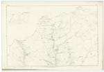
[Page] 191Parish of Moffat Plan 9.13 Trace 1
[signed] W. Paterson c/a [civilian assistant]
Transcribers who have contributed to this page.
norma
Location information for this page.