OS1/10/36/174


| List of names as written | Various modes of spelling | Authorities for spelling | Situation | Description remarks |
|---|---|---|---|---|
| RASHYBRIGGS | Rashybriggs Rashybriggs Rashybriggs Rashie Briggs |
Estate Plan Robert Hannah David Henderson John Henderson Robert Harkness |
050 | [situation] 29 chains S.W. by W. [South West by West] from the Centre of Hightae. A small cottage and garden the property of John Brown. It bears its name from the plan through which the Rangegill Burn passes which [then] is called Rashy Briggs. |
| ROBERT MOOR | Robert Moor Robert Moor Robert Moor |
Robert Hannah David Henderson Robert Wright |
050 | [situation]½ mile S.W. [South West] of Hightae. A large tract of land mostly of wood and arable fields on the west corner of this plan. |
| MOSSBURN | Mossburn Mossburn Mossburn |
Estate Plan County Valuation Rolls of 1827 Robert Hannah |
050 | [situation]½ mile S.W. by W. [South West by West] of Hightae. A farmhouse with outbuildings , garden and Stackyard the property of W.B. McDonald Esq. |
Continued entries/extra info
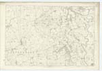
[page]174Parish of Lochmaben
Plan 50.12 Trace 1
[signed]Samuel S. Hill
Lce.Corprl.R.S.M. [Lance Corporal Royal Sappers & Miners]
Transcribers who have contributed to this page.
Chr1smac -Moderator, Andrew Armstrong
Location information for this page.
Linked mapsheets.