OS1/10/36/137


| List of names as written | Various modes of spelling | Authorities for spelling | Situation | Description remarks |
|---|---|---|---|---|
| THORNIEWHAT MOOR | Thorniewhat Moor Thorniewhat Moor Thorniewhat Moor |
Thomas Tait Esqr. John Henderson Thomas Johnston |
050 | [situation] From 2 miles S.W. [South West] of Lochmaben - westwards - An extensive tract of high uncultivated moorland. Andrew Johnston Esqr. owner Thomas Johnston occupant. |
| THORNIEWHAT | Thorniewhat Thorniewhat Thorniewhat Thorniequhat Thornywhat Thornythwaite Thorniewhat Thorniewhat |
Thomas Tait Esqr. John Henderson Peter Graham Esqr. Valuation Rolls of 1667 Valuation Rolls of 1829 Johnstones County Map Andrew Johnstone Esq. Revd. W. Browne |
050 | [situation] 1⅔ of a mile S.S.W. [South South West] of Lochmaben. A farmhouse and outbuildings with garden and lands attached. Andrew Johnston Esqr owner. Thomas Johnston occupant. |
| HARTWOOD MOOR | Hartwood Moor Hartwood Moor Hartwood Moor Hartwood Moor Harthet Moor |
John Wright John Henderson Thomas Johnston Andrew Johnston Esq Revd. W. Browne |
050 | [situation] From 2 to 3 miles S.S.W. [South South West] of Lochmaben. An extensive tract of high uncultivated moorland. Andrew Johnston Esqr. owner and occupant. |
Continued entries/extra info
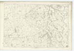
[page]137Parish of Lochmaben
Plan 50.7 Trace 4
[Signed]P.Munro
Pte.R.S.M. [Private Royal Sappers & Miners]
Transcribers who have contributed to this page.
Andrew Armstrong
Location information for this page.
Linked mapsheets.