OS1/10/36/132


| List of names as written | Various modes of spelling | Authorities for spelling | Situation | Description remarks |
|---|---|---|---|---|
| MARLAKE BURN | Marlake Burn Marlake Burn Marlake Burn Marlake Burn |
Mr John Brotch William Harkness Esqr Peter Graham Esqr Johnstone's Co. Map |
050 | [situation] From near the West side of parish S.E. [South East] to Hightae Loch. A stream having its source in the parish of Torthorwald and falls into Hightae Loch. |
| MURTHAT or DEIL'S DIKEDIKE | Murthat Dyke Murthat Dyke Murthat Dyke Deil's Dike Celtic Dyke |
James Henderson Joseph Harkness Esqr Peter Graham Esqr William Harkness New Statistical Account of Scotland Simpson's History of Sanquhar |
050 | [situation] About 1½ miles S.S.W. [South South West] of Lochmaben. A ridge like shape said to have been a Roman wall. A large embankment of a zig-zag form - it appears to be a natural feature; it is remarkable alike from its shape as the substance of which it is composed being of gravel whereas the surrounding land was formerly moor. ...reclaimed. This embankment is not continuous but appears in portions here and there , and the ... state that it can be traced from the Solway Firth to the interior of the country beyond this parish; ... suppose it to have been a Roman work, but this....extremely doubtful as there is no evidence of a .... consequentr an the construction of ... an object. |
Continued entries/extra info
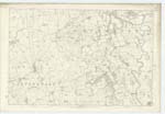
{page]132Parish of Lochmaben
Plan 50.7 Trace 1
[Signed]P.Munro
Pte.R.S.M. [Private Royal Sappers & Miners]
[Signed]J. Augh Cat R.M.
Transcriber's notes
Description not complete due to curvature of scanned page obscuring words close to RH margin of page.Transcribers who have contributed to this page.
Andrew Armstrong
Location information for this page.
Linked mapsheets.