OS1/10/36/129


| List of names as written | Various modes of spelling | Authorities for spelling | Situation | Description remarks |
|---|---|---|---|---|
| THORNIEWHAT HILL | Thorniewhat Hill Thorniewhat Hill Thorniewhat Hill Gillyshaw Hill |
A.Johnston Esqr David Wright Richard Sanders George Johnston |
050 | [situation] 2½ miles S.W. by S. [South West by South] from Lochmaben. A considerable hill on the farm of Thorniewhat. Andrew Johnston Esqr owner. Thomas Johnston occupant. Is commonly called Thorniewhat Hill. |
| THORNIEWHAT BURN | Thorniewhat Burn Thorniewhat Burn Thorniewhat Burn |
George Johnston John Henderson John Richardson |
050 | [situation] From the West side of Hightae Loch in a South West direction. A small rivulet on the farm of Thorniewhat and falls into Hightae Loch. |
| HARTWOOD MOOR | Hartwood Moor Hartwood Moor Hartwood Moor |
William Graham John Henderson Thomas Grierson |
050 | [situation] 2½ miles S. [South] of Lochmaben extending west for 1 mile. An extensive tract of high uncultivated moorland. Andrew Johnston Esqr owner and occupant. |
Continued entries/extra info
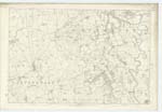
[page]129Parish of Lochmaben
Plan 50.6 Trace 3
[signed]P.Munro
Pte.R.S.M. [Private Royal Sappers & Miners]
Transcribers who have contributed to this page.
Andrew Armstrong
Location information for this page.
Linked mapsheets.