OS1/10/34/233


| List of names as written | Various modes of spelling | Authorities for spelling | Situation | Description remarks |
|---|---|---|---|---|
| DUMGREE CHURCH (Remains of) | Dumgree Church (Remains of) Dumgree Church (Remains of) Dumgree Church (Remains of) Dumgree Old Kirk Dumgree Church Dun-Dum or Dumgree Church Dumgree Dumgree |
Herbert Renwick John Henry Joseph Cowan Johnstone's County Map Fullarton's Gazetteer Chalmer's Caledonia New Statistical Acct [Account] of Dumfriesshire New St. Acct. [Statistical Account] |
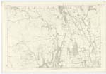
024 | [Situation] 49 chains N.E. [North East] from Barntimpen. This is the site of the parish Church of the Ancient parish of Dumgree which was united with Kirkpatrick Juxta in 1609. The wall is entirely demolished and the stones have been carried away, only the breadth of the foundations visible. There is a small space attached now used as a burial ground. Druim-a hill grean- the burn. Drumgrian Church. |
| KINNEL WATER | Kinnel Water Kinnel Water Kinnel Water Kinnel Water |
Herbert Renwick Park John Henry Hillhead Joseph Cowan Boreland Johnstone's Map |
[Situation] From N.Wn. Ph. [North Western Parish] Boundary s.E. [South East] on to Sn. Ph. [Southern Parish] Boundary. A small river which rises on the farm of Kinnelhead and flows in a southerly direction to its confluence with the River Annan, in the immediate neighbourhood of Lochmaben. |
Continued entries/extra info
[page] 233Parish of Kirkpatrick Juxta
Plan 24.14 Trace 3
Philip Munro Ln Corpl R.E. [Lance Corporal Royal Engineers]
Transcribers who have contributed to this page.
norma
Location information for this page.
Linked mapsheets.