OS1/10/34/221


| List of names as written | Various modes of spelling | Authorities for spelling | Situation | Description remarks |
|---|---|---|---|---|
| PLEWLANDS BURN | Ploughland Burn Ploughland Burn Ploughland Burn Plewlands Burn |
Herbert Renwick Park George Brown Newbank John Henry Hillhead Johnston's County Map |
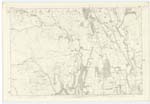
024 | [Situation] From Goosedub Moss N.E. [North East] to Kinnel Water. A Rivulet which rises in Goosedub Moss and flows in an easterly direction to its Confluence with Kinnel Water. |
| KEN RIG | Ken Rig Ken Rig Ken Rig |
Herbert Renwick George Brown John Henry |
024 | [Situation] ¼ mile N.N.E. [North North East] from Park. An eminence of a ridge like shape situated on the farm of Park. Its soil consists of Arable land. |
| PLEWLANDS | Ploughlands Ploughlands Ploughlands Plewlands Plewlands |
Herbert Renwick George Brown John Henry Johnston's County Map Charles Stewart Esq Hillside |
024 | [Situation] ¾ mile N. [North] from Park. A farmhouse and outbuildings with garden and lands attached, in middling repair, the property of J.J. Hope Johnstone M.P. |
Continued entries/extra info
[page] 221Parish of Kirkpatrick Juxta
Plan 24.11 Trace 1
Philip Munro Ln. Corp: R.E. [Lance Corporal Royal Engineers]
Transcriber's notes
In Modes of Spelling 'Goosedub Moss' is added in red ink.In Modes of Spelling 'Plewlands' is added in red ink.
Transcribers who have contributed to this page.
norma
Location information for this page.
Linked mapsheets.