OS1/10/34/1


| List of names as written | Various modes of spelling | Authorities for spelling | Situation | Description remarks |
|---|---|---|---|---|
| KIRKPATRICK JUXTA | Kirkpatrick-Juxta | Walkers' Map of Scotland Craword's Map of Dumfriesshire Johnston's Map of Dumfriesshire |
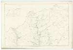
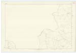
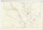
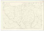
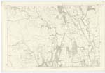
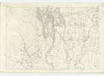
009; 015; 016; 023; 024; 033 | Situation Near the Nn. [Northern] extremity of Dumfriesshire and adjoining Lanarkshire on the South. The Name of this Parish was anciently written Kirkpatrick - derived from the famous missionary St. Patrick.- It is now written Kirkpatrick-Juxta as being nearer to the capital of Scotland than Kirkpatrick-Fleming._ The Parish of Kirkpatrick-Juxta is of irregular formation being bounded on the North by Moffat, on the East by Moffat and Wamphray, on the South by Johnstone and Kirkmichael and on the West by Closeburn and Crawford in Lanarkshire. There is no detached part of another Parish within its limits, nor is there a detached portion of it within the boundaries of any other Parish. -Its entire Area is now Computed at 22,465.263 Acres, of which about 8,200 may be arable, 265 wood and 1400 pasture And irreclaimable land and of which about 2,000 Acres are Capable of Cultivation. The mountain range of Queensberry on the West runs irregularly northward, Another range of lower hills on the East extends in a parallel direction between two and three miles distant, - and between these two ranges is the pastoral valley of Kinnel Water.- Betwixt the latter range and the River Annan on the En. [Eastern] Parish Boundary the tract of ground is nearly two miles broad and 8 miles long And which Consists of hill and vale and Constitutes most of the richer and more valuable portion of the Parish.- It Consists of lands formerly moor, which are mostly now Arable though About One tenth of the whole is either rock or moor land.- The principal Streams are Kinnel Water from N.Wn. [North Western] district which running S.E. [South East] onto the Southern Parish Boundary falls into River Annan, - nearly intersecting the Parish; Duff-Kinnel Water on the S.Wn. [South Western] boundary running also S.E. [South East] forms a Confluence with Kinnel Water on the boundary between Johnstone And this Parish; Evan Water from the Moffat Parish, running S. E. [South East] through N. En. [North Eastern] district, which falls into River Annan on the En. [Eastern] boundary and River Annan which forms the En. [Eastern] Parish Boundary.- Numerous rills And Springs occur throughout, Some of the latter of mineral repute.- The Caledonian Railway from Moffat runs S.S.E. [South South East] through En. [Eastern] division of Parish on which there is a first-class Station called Beattock Station. There is one Turnpike road from Glasgow to Carlisle and Another intersecting it at Beattock-bridge Hotel from Dumfries to Edinburgh, the entire length of these lines being about 20 miles. No minerals are wrought nor manufactory carried on.- The only village is Craigielands in the En. [Eastern] district consisting of neat Small buildings on a regular plan. The Ph. [Parish] Church built in 1799, is Conveniently Situated for the population, in the En. [Eastern] district; it Accommodates About 600 and affords 50 free Sittings; - Stipend £220. - There is no other place of worship within this Parish. - There are two parochial Schools [continued on next page] |
Continued entries/extra info
[Page] 1 -- Parish of Kirkpatrick-Juxta -- County of DumfriesTranscribers who have contributed to this page.
Chr1smac -Moderator, Moira L- Moderator, mikeh
Location information for this page.
Linked mapsheets.