OS1/10/30/61
| List of names as written | Various modes of spelling | Authorities for spelling | Situation | Description remarks |
|---|---|---|---|---|
| NETHERTOWN HILL | Netherton Hill | William Stuart John Laing William Wilson |
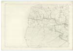
001 | [situation] About 1/2 mile S.E. [South East] from Mid Rigg. A portion of the ridge of hills that bounds the valley of the Nith on the north, situated on the Knowe Farm, to the east of the dyke that forms the march between the Knowe and Netherton Farms. The boundary between the Counties of Ayr and Dumfries passes a short distance to the north of this hill. |
| LAGRAE BURN | Lagrae Burn | William Stuart The Revd. [Reverend] Donaldson John Laing |
001; 005 | [situation] From the Nn. [Northern] base of Netherton Hill S.E. by S. [South East by South] to River Nith. A small stream having its source to the north of Netherton Hill, and flowing some distance to the east takes a bend to the South and flows on in that direction until it falls into the River Nith. |
Continued entries/extra info
[page] 61Parish of Kirkconnell Sheet 1.15 Trace No 3
[note at Nethertown] Nethertown - See Page 128 for Authorities
[signed] C.A. [Civilian Assistant] Thomas Matheson
Transcribers who have contributed to this page.
CRIMSON
Location information for this page.


