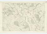
OS1/10/29/67
| List of names as written | Various modes of spelling | Authorities for spelling | Situation | Description remarks |
|---|---|---|---|---|
| HIGHWELL BANK | Highwell Bank Highwell Bank Highwell Bank |
William Hunter Arundell Esq James Lorimer Andrew Stobo |
031 | [Situation] About 13 chains North ofBaaaaarjarg Village. A small mixed plantation Situated on a Steep between Drum Bank and Tor Knowe the property of William Hunter Arundell Esq. the name is taken from its being on a brow under "High Well". |
| BARJARG | Barjarg Village Barjarg Village Barjarg Village Barjarg Barjarg Barjarg Barjarg |
W H Arundell Esq James Lorimer James McCubbin William Carrson [Auctioneer] Johnstone's Co. [County] Map Stat Acc [Statistical Account ] of Dumfries Valuation Roll in 1827 |
031 | [Situation] Abut 25 chains N.E. [North East] of Barjarg Tower. A small range of Buildings 5 chains long Situate on the E. [East] Side of the Road between Dumfries and Penpont. About 2 miles from the former & 4 from the latter it derived its name from Barjarg house which is a very old building it is the property of WilliamHunter Arundell Esq and occupied by him. |
| BARJARG QUARRY | Barjarg Quarry Barjarg Quarry Barjarg Quarry |
W H Arundell Esq James Lorimer James McCubbin |
031 | [Situation] About 7chains South-West of Barjarg Village. Large and extensive Lime Works. There are three Kilns but two of which are in a ruinous condition, the greater part of the Stone is take out of a mine and conveyed to the kiln by means of Iron Trucks . The Mine is about 150yards under Ground, the property of W H Arundell Occupied by William McCaig. A Limestone Quarry near Barjarg Tower. |
Continued entries/extra info
[Page] 67[Parish of Keir] Plan 31.15 Trace No. 1
Transcribers who have contributed to this page.
auntylexa
Location information for this page.
Linked mapsheets.


