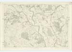
OS1/10/29/56


| List of names as written | Various modes of spelling | Authorities for spelling | Situation | Description remarks |
|---|---|---|---|---|
| THE DODD | The Dodd The Dodd The Dodd |
Mr John Douglas Mr William McMurdoch Mr William Kirkpatrick |
031 | [Situation] Towards the South Eastern corner of Barjarg Moor. The northern ridge of Barjarg Moor stretching from the west [WJ initials] end of Hightown Plantation to the Preaching Stone, and on the culminating point of which stands a trigonometrical Station. |
| GARROCH BURN | Garroch Burn garroch Burn Garroch Burn Garroch Burn Garroch Burn Gerroch Burn |
Mr John Black Mr William McMurdoch Mr William Wilson W H Arundell Esq William Lawson See Page 47 |
031 | [Situation] In a North Eastern direction towards "The Lake".A Small Stream formed near High Porterstown by the junction of several Streamlets rising on Barjarg Moor & in Beuchan Hill Plantation. & bears the name to its junction with "The Lake". |
| HIGH PORTERSTOWN | High Porterstown High Porterstown High Porterstown |
Mr William MvMurdoch Mr William Wilson Mr William Kirkpatrick |
031 | [Situation] About 6 chains East of Garrach Burn. The ruins of an old farm which was known by this name. |
| THE DEVIL'S STONE | The Devil's Stone The Devil's Stone The Devil's Stone |
Mr William McMurdoch Mr William Wilson Mr James Sharp |
031 | [Situation] About 16 chains N.E. [North East] of High Porterstown. A large Stone on the farm of Porterstown. There is a superstitious tradition that the mark of the devil's hoof may be seen on the stone, or on the ground near it. It has not the appearance of a druidical Stone, and is not regarded as such in the district. |
Continued entries/extra info
[Page] 56Ph. [Parish] of Keir Plan 31.14 Traces 1 & 2 & 3
Transcribers who have contributed to this page.
auntylexa
Location information for this page.
Linked mapsheets.