OS1/10/28/29


| List of names as written | Various modes of spelling | Authorities for spelling | Situation | Description remarks |
|---|---|---|---|---|
| DEER EDGE | Deeredge Rig Deeredge Rig Deeredge Rig Deeredge Rig Deer Edge Deer Edge Deer Edge Deer Edge Deer Edge |
Charles Blacklock George Brown Adam Thompson Mr Stewart factor for Raehills George Henry William Coupland William Elliot Johnstone's County Map New Statistical Account of Dumfriesshire |
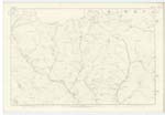
023; 024 | A hill of a ridge like shape situated a little to the north of Minnygap height. Either of the following may be the primary root of this name, viz, deer, deir, dair, dare, derry, dar, daray, darach, daredge seems to be the correct mode. About 1300 feet . Considered to be about the highest hill in the Parish. |
| MINNYGAP HEIGHT | Minnygap height Minnygap height Minnygap height Minnygap height |
Charles Blacklock George Brown Adam Thompson Mr Stewart factor for Raehills |
024 | An eminence of great height at the north western extremity of the lands of Minnygap. Upwards of 1300 feet. |
Continued entries/extra info
OSI/10/28/29Deeredge Rig situation on the Boundary between Johnstone and Kirkpatrick Juxta
Transcribers who have contributed to this page.
stellas
Location information for this page.