OS1/10/27/61


| List of names as written | Various modes of spelling | Authorities for spelling | Situation | Description remarks |
|---|---|---|---|---|
| GILLESBIE HILL | Far Hill Far Hill Far Hill Gillisbie Hill Gillesbie Gillesbie Gillesbie Gillesbie |
John Graham Esqr. William Rogerson Esqr. Mr. James G Scott, Berry Scar John Earsman Windshiel Johnston's County Map New Statistical Account of Dumfries. Old and New Valuation Rolls. The Old Statistical Acct. [Account] of Parish. |
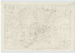
034 | [Situation] 1/2 mile East from Rushbush Rig. A round hill of considerable elevation. |
| DRAGON'S PLANTATION | Dragon's Plantation Dragon's Plantation Dragon's Plantation |
John Graham Esqr. William Rogerson, Esqr. Mr. James G. Scott |
034 | [Situation] S.S.W. [South South West] of Gillesbie Hill. A small fir plantation, so named at the time it was planted. |
| SAUGHY GUTTER | Saughy Gutter Saughy Gutter Saughy Gutter |
John Graham Esqr. William Rogerson Esqr. John Erseman, Shankend |
034 | [Situation] Between Rushbush Rig and Gillesbie Hill. Rises on the east of Goodwife's Hill, and runs into Cauld-del Burn. |
Continued entries/extra info
[Page] 61Hutton & Corrie -- Sheet 34.2 Trace 4
[Signed] John Jane
Sapper R.E. [Royal Engineers]
Transcribers who have contributed to this page.
CorrieBuidhe- Moderator, norma, cpm
Location information for this page.
Linked mapsheets.