OS1/10/27/146


| List of names as written | Various modes of spelling | Authorities for spelling | Situation | Description remarks |
|---|---|---|---|---|
| DORMONT RIG | Dormont Rig Domont Rig Dormont Rig |
John Bell Robert Bryden John Dobie |
034 | [Situation] About 1/2 mile N.E.E. [North East East] from Carterton. A large hill on the Cow Burn farm, on its Summit is the remains of an old Camp. |
| FORT (Remains of) [Dormont Rig] | British Fort (Site of) British Fort (Site of) British Fort (Site of) |
John Bell Robert Bryden John Dobie |
034 | [Situation] On Dormont Rig. A old Camp on the Summit of Dormont Rigg, is in very good preservation. |
| COW BURN | Cow Burn Cow Burn Cow Burn |
John Bell Robert Bryden John Dobie |
034; 035 | [Situation] From the East Side of Parish S.S.W. [South South West] to Corrie Water. A small stream having its source from the base of Knock from whence it flows in a Southerly direction empties itself into Corrie water |
Continued entries/extra info
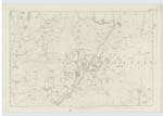
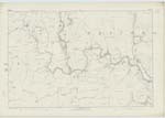
[Page] 146Parish of Hutton and Corrie -- Plan 34.16 Trace 3
[Signed] Samuel S Hill
2nd Corpl.R.E. [Second Corporal Royal Engineers]
Transcribers who have contributed to this page.
CorrieBuidhe- Moderator
Location information for this page.