OS1/10/22/96


| List of names as written | Various modes of spelling | Authorities for spelling | Situation | Description remarks |
|---|---|---|---|---|
| Solway Firth | Solway Firth Solway Firth Solway Firth |
Blackwoods Map Crawford Map New Statistical Account |
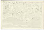
063 | [Situation] To the South of this Parish. A navigable arm of the Sea which extends Eastwards from the [Irish] Sea forming the boundary between [England] and Scotland for upwards of 50 [miles]. The shore is flat and sandy with a [sunken] rock's but almost every part affords landing places for small vessels of [100] tons to within 6 miles of its extremity. |
Continued entries/extra info
[Page] 96Gretna parish Sheet 63.15
Transcribers who have contributed to this page.
DANIALSAN, PeterRSL
Location information for this page.
Linked mapsheets.