OS1/10/20/161


| List of names as written | Various modes of spelling | Authorities for spelling | Situation | Description remarks |
|---|---|---|---|---|
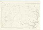
| TOD SIKE | Tod Syke | John Ogilvie Farmer Cooms Simon Rutherford Shepherd Lodgegill |
037 | [Situation] At the N.W. [North West] side of Tod Knowe A small stream having its source from surface water between the bases of Watch Hill, & Cloak Knowe; it flows from that in a south westerly direction, and falls into Cooms Burn, about a half mile above Cooms. |
| WATCH HILL | Watch Hill | John Ogilvie Farmer Cooms Simon Rutherford Shepherd Lodgegill |
037 | [Situation] On the boundary between Dumfries and Roxburgh Shires. A large hill the surface of which is rough & heathy pasture, on the farm of Cooms. There is a Trigl. [Trigonometrical] Station on its highest point. |
| CLOAK KNOWE | Cloak Knowe | Described on Sheet 37 No. 9 | ||
| HAG SIKE | Hag Syke | Described on Sheet 37 No. 6 | ||
| LODGE GILL | Lodge Gill | Described on Sheet 37 No. 6 | ||
| TOD KNOWE | Tod Knowe | Described on Sheet 37 No. 9 |
Continued entries/extra info
[Page] 161Parish of Ewes -- Sheet 37 -- No. 10 -- Trace 1
[Signed] P. McHugh
Lce. Corpl. RE [Lance Corporal Royal Engineers]
Transcribers who have contributed to this page.
CorrieBuidhe- Moderator, gengirl44
Location information for this page.