OS1/10/13/33


| List of names as written | Various modes of spelling | Authorities for spelling | Situation | Description remarks |
|---|---|---|---|---|
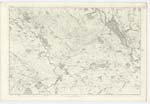
| CAIRN WATER | Cairn Water Cairn Water Cairn Water |
Johnstones County Map Thomas Black Townhead John Smith White gate |
040; 048 | [Situation] Tracing for the most part the Western Parish Boundary on this plan. A large Stream partly forming the Boundary between the Ph. [Parish] of Dunscore and Glencairn |
| BIRKSHAW BURN | Birkshaw Burn Birkshaw Burn Birkshaw Burn |
Thomas Black James Stitt Sheperdland Bur John Smith |
040 | [Situation] Tracing the North And N. [North] Western Parish Boundary of this Plan. A small stream flowing in a westerly direction and falls into the Cairn Water South west from Dunscore |
| TOWNHEAD | Townhead Townhead Townhead Townhead |
James Stitt Thomas Black John Smith Johnstone's Co. [County] Map |
040 | [Situation] About 14 Chains S.E.E. [South East by East] of the junction of Birkshaw Burn And Cairn Water. A small farm house and outbuilding the property of James Greirson Esq occupied by Thomas Black. |
Continued entries/extra info
[Page] 33Plan 40/10 Trace No. 1 Dunscore Parish
Transcriber's notes
Note Birkshaw Burn falls into Cairn Water North West of DunscoreTranscribers who have contributed to this page.
DANIALSAN, Stoofer
Location information for this page.