OS1/10/13/128


| List of names as written | Various modes of spelling | Authorities for spelling | Situation | Description remarks |
|---|---|---|---|---|
| COLDSIDE | Coldside | John McKinnel Esqr. John Hiddlestones Esqr. William Hunter |
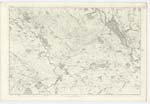
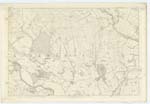
040; 041; 048; 049 | [Situation] In the South of Coldside Road. Another poor district of Country with an exposed northern Slope. There is no distinct boundary defining its limits, but it may be considered to commence on the east about the top of Camp-hill On the north it runs into plan 40/12 where the land becomes level and more fertile, on the South it extends as far as McCubbington hill, Hazelwood, & Upper Kilroy, and on the east it may be considered to terminate at the Parish Boundary. |
| COLDSIDE ROAD | Coldside Road | John McKinnel Esqr. Mr Stitt John Hiddlestones Esqr. |
040; 041 | [Situation] From .W. [North West] running S.S.E. [South South East] through this Plan. A Public Road running through the district of Coldside. Its general direction is east and West, but at Dinning it branches off to the West & meets the Dunscore and Dumfries Road. |
Continued entries/extra info
[Page] 128Plan 40/16 Trace 2 Parish of Dunscore
Transcribers who have contributed to this page.
DANIALSAN, Stoofer
Location information for this page.