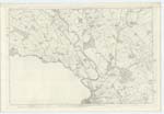
OS1/10/11/99
| List of names as written | Various modes of spelling | Authorities for spelling | Situation | Description remarks |
|---|---|---|---|---|
| CLUMPTON HILL | Clumpton Hill Clumpton Hill Clumpton Hill |
J.W. Paterson Mr. Houston William Jackson |
055 | [Situation] - To the N.W. [North West] of this plan 12 Chains N.W. [North West] from Clumpton. - An elevated Ridge on which Stands a Trigl. [Trigonometrical] Station, it is said that Druidical rites were performed here |
| CARNSALLOCH MOSS | Carnsalloch Moss Carnsalloch Moss Carnsalloch Moss Carsalloch Carnsalloch Carnsalloch |
J.W. Patterson Mr. Houston Mr. Jackson Valuation Roll StatAcct. [Statistical Account] of Kirkmahoe Vide Authorities, Kirkmahoe book Description of Parliamentary Boundaries 1833 |
049 | [Situation] - To the N. [North] of this Plan, S. [South] of Burnt Firs and adjoining thereto. - A large portion of Lochar moss the property of Col. [Colonel] Johnstone of Cairnsalloch |
| LONG PLANTATION | Long Plantation Long Plantation Long Plantation |
J.W. Patterson Mr. Houston Mr. Jackson |
049 | [Situation] - S.e. [South East] of Clumpton Hill - A fir plantation, trees of average size & closely planted, the property of Col. [Colonel] Johnstone |
Continued entries/extra info
Plan 49.16 -- Trace No. 1 -- Parish of Dumfries[Note] The Gazr [Gazetteer] of Scotland says" The picturesque height called
"Clumpton was probably at an early period a mountain [glen]
"and haunt of the Druids"- At a later period it was used as
a beacon post as Commanding the considerable expanse of
Country which it overlooks.-
Transcribers who have contributed to this page.
Chr1smac -Moderator
Location information for this page.


