OS1/10/11/279


| List of names as written | Various modes of spelling | Authorities for spelling | Situation | Description remarks |
|---|---|---|---|---|
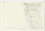
| TROHOUGHTON MOOR | Trohoughton Moor Trohoughton Moor Trohoughton Moor |
John Carruthers William Swan Thomas Halliday |
055 | [Situation] at the North and on Sheet Line of Plan - A tract of Cultivated land attached to th farm of Trohoughton formerly a Moor. |
| BUSH MOOR | Bush Moor Bush Moor Bush Moor |
John Carruthers William Swan Thomas Haining |
055 | [Situation] To the S.E. [South East] and adjoining Trohoughton Moor.- A portion of Moorland, partly Cultivated Attached to the Bush Farm. |
| KELWOOD BURN | Kellwood Burn Kellwood Burn Kellwood Burn Kelwood Burn |
John Carruthers William Swan Thomas Haining Dr. Singer's Agl [Agricultural] Survey |
055 | [Situation] In a S.E. [South East] direction through this Plan A Small Stream having its source on Trohoughton Moor, passes by Kellwoodmoor & the Ph. By. [Parish Boundary] falls into Lochar Water. |
| HIGH ROAD | High Road High Road High Road |
John Carruthers William Swan Thomas Haining |
055 | [Situation] In a N.W. [North West] direction through this Plan. A parish road, leading from Dumfries to BanKend, bears the name from Dumfries to the Parish By. [Boundary]. |
Continued entries/extra info
[Page] 279 -- Plan 55.16 Trace No. 2 & 3Transcribers who have contributed to this page.
Chr1smac -Moderator
Location information for this page.
Linked mapsheets.