OS1/10/11/277


| List of names as written | Various modes of spelling | Authorities for spelling | Situation | Description remarks |
|---|---|---|---|---|
| RIVER NITH | River Nith River Nith River Nith |
Stat. Acc: [Statistical Account] of Dumfries Gazetteer of Scotland Walker's Map of Scotland |
055 | [Situation] Tracing Western Parish Boundary on this Plan. A Considerable River which is here navigable for vessels of 50 or 50 Tons burthen |
| THE MERSE | The Merse The Merse The Merse |
John Carruthers Mr. Stott Mr. McKeon |
055 | [Situation] in the N.E. [North East] of River Nith on this Plan. A low lying tract of grass land, liable to flood at high tides. |
| LOW ROAD | Low Road Low Road Low Road |
John Carruthers Mr. Watt Mr Russell |
055 | [Situation] From N.N.E. [North North East] of this Plan A Parish road leading from Dumfries to the Old Quay, it bears the name from NithbanK to the Parish By [Boundary] at Kelton. |
Continued entries/extra info
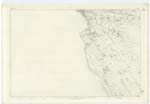
[Page] 277 -- Plan 55.15 Trace No. 1 --- Parish of Dumfries[Signed] O. Barrett c/a [civilian assistant]
per Hugh Doherty
1st. Examr. [Examiner]
Transcribers who have contributed to this page.
Chr1smac -Moderator
Location information for this page.
Linked mapsheets.